Two things have happened recently that will dramatically change the way your GPS rover works.
First, there are completely new GNSS capabilities from new satellites, new GPS systems, and new types of radio signals coming from space. Second, Inertial Measurement Unit (IMU) was added to the Trimble SPS survey Rover.
JUMP TO SECTION
Global Positioning Systems Update
In the early days, anytime there was an update to the only working GPS (called NAVSTAR) it made frontpage news. Today, updates occur almost daily to what is referred to as GNSS (Global Navigation Satellite Systems), the plural of GPS, denoting multiple GPS systems from different countries around the world. These GNSS systems can all work together depending on the capability of your receiver.
New Coming from Space
Stronger radio signals are coming from space.
Back in February of 1978, when the first GPS satellite was launched, the battery technology was not what it is today. The original GPS system was designed to broadcast only a very weak radio signal. Newer satellites with newer battery technology are capable of broadcasting much stronger signals. This translates to better coverage across the earth including under trees, alongside structures, inside buildings, and basically using your GPS in places you’ve never been able to before.
Newer and more complex types of radio signals.
In what’s being called Modernized Civil GPS, satellites are broadcasting L1c, L2c and L5 radio signals. This provides a higher signal power and forward error correction drastically improves GPS availability plus increases accuracy.
There are many, many more GPS satellite systems available to make up the GNSS.
From an original 24 satellite constellation (called NAVSTAR) to the multiple satellite systems that make up the GNSS today, there is now coverage anywhere and at any time.
Current list of working GPS:
- BeiDou GPS owned and operated by Peoples Republic of China
- Galileo GPS owned and operated by the European Union
- GLONASS operated by the Russian Federation
- IRNSS is a regional GNSS owned and operated by the Government of India
- QZSS run by the Government of Japan
- NAVSTAR is the original GPS system developed and run by the US Government.
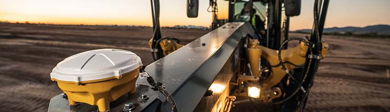
Inertial Measurement Unit (IMU)
If you are using a Trimble GNSS base and rover then you might already know that there is a multitude of new innovations. The one that really blew me away is the added implementation of an IMU into the receiver head. An IMU is a small computer chip capable of measuring angle, force, and rotation. If you’ve used the level bubble on your smart phone, you’ve seen what an IMU chip does. You can find IMU chips in drones, games controllers, military missiles, automobiles and even your iPhone. It’s amazing how accurate these little chips can measure even the slightest measurement. When added to the Trimble SPS986 GPS rover head, it eliminates the need to keep the pole plumb. The IMU measures the pitch and roll to offset the angle to the bottom of your survey pole. It basically turns your 2-meter rover pole into a magic wand.
I first saw the actual accuracy and ease of use while performing an as-built for an industrial site full of pipes and structures. In the past, I would never attempt using GPS in a jobsite like this. Using the IMU I was amazed at how well the Trimble rover worked. The Trimble SPS986 rover head in conjunction with Trimble Siteworks software provides what is called tilt compensation. All you need to do is hold the pole tip to whatever you’re trying to measure, at any angle, and it records the point at the tip of the pole extremely accurately. While measuring corners of buildings and structures, you’ll notice how tight the corners are and how accurate the actual locations are. I have been surveying for over 30 years and of all the innovation this blew me away. If you haven’t seen this firsthand, contact a SITECH Southwest representative for a demonstration. It’s truly amazing.