WingtraRAY
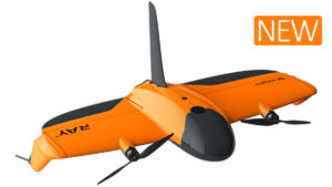
FLYING TIME:*
59 Minutes
ACREAGE PER FLIGHT:*
1359 Acres
Post-Processed Kinematic (PPK) GPS for high-accuracy projects. Ideal for mapping and surveying large and medium-sized projects.
Freefly Astro & Alta X
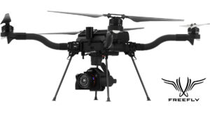
FLYING TIME:*
41 Minutes
ACREAGE PER FLIGHT:*
100 Acres
Realtime or Post-Processed Kinematic (PPK) GPS for high-accuracy projects. medium size quadcopter with flexibility.
WingtraOne Gen II
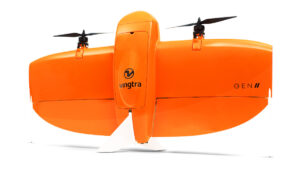
FLYING TIME:*
59 Minutes
ACREAGE PER FLIGHT:*
760 Acres
Post-Processed Kinematic (PPK) GPS for high-accuracy projects. Ideal for mapping and surveying medium to large-sized projects.
Autel EVO II V3
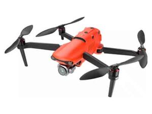
FLYING TIME:*
36 Minutes
ACREAGE PER FLIGHT:*
100 Acres
Realtime or Post-Processed Kinematic (PPK) GPS for high-accuracy projects. Small and easy to fly quadcopter for small to medium-sized projects.
DJI Mavic 3 Enterprise

FLYING TIME:*
45 Minutes
ACREAGE PER FLIGHT:*
247 Acres
Realtime or Post-Processed Kinematic (PPK) GPS for high accuracy projects. Ideal for mapping & survey, jobsite inspections, fire, police, film and video production. Small and easy to fly for small to medium-sized projects.
DJI Matrice 350

FLYING TIME:*
40 Minutes
ACREAGE PER FLIGHT:*
700 Acres
Realtime or Post-Processed Kinematic (PPK) GPS for high accuracy projects. Ideal for mapping & survey, jobsite inspections, fire, police, film and video production. Medium sized and easy to fly for medium to large-sized projects.