
With the variables and nuances of constructing a corridor, collecting data in the most proficient and comprehensive way is crucial. In this article we go over components and stake features that are both required when using an SPS controller and helpful in executing your data.
JUMP TO SECTION
Staking Corridor Features
Corridor features are defined as points of interest along a cross-section of an alignment. These features can include centerline, edge of pavement, a back of curb property line or any other items of interest.
Corridors can be defined in Trimble Business Center or in the data collector, but to stake or enter corridors with an SPS controller the roading module is required.
Corridor Components:
Corridors are comprised of three basic data types.
- Horizontal Alignment
- Lines and curves
- Stationing information
- Vertical Alignment
- Grade breaks and vertical curves
- Cross Section Templates
- Horizontal offset perpendicular to a line (typically centerline)
- Vertical difference, defined as a slope or offset
- Can contain side slopes for staking the daylight (catch point) of a slope
Corridor Field Staking
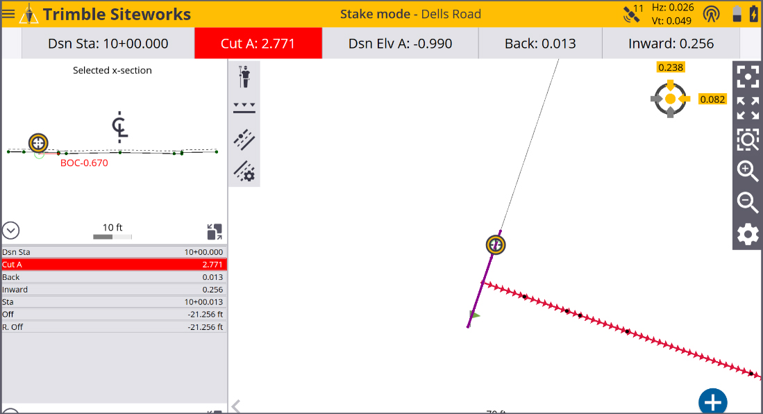
When staking a feature in the field the user selects the feature they want to stake and then can apply an optional horizontal and/or vertical offset.
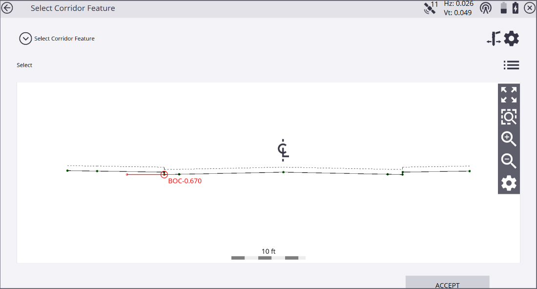
In this case, I selected back of curb with a horizontal offset of five-feet and a vertical offset of eight-inches to sub-grade.
Once the corridor and feature are selected the user is returned to the stake screen where they are given guidance to stake the current feature. As with staking, at any line the user can stake features at specified stations, or stake random stations, with a simple press of a button.
Marking the Lath
One of the benefits of using corridors to stake corridors is that once the feature is staked, not only do we get a cut or fill to the feature, we also get a storyboard with offsets and cut and fill data for every feature in the cross section.
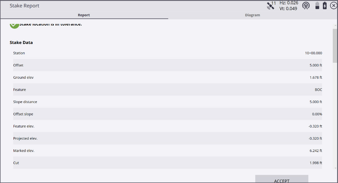
The stake report selected feature with station, offset and cut and fill, simulates staking a line with a single cut/fill.
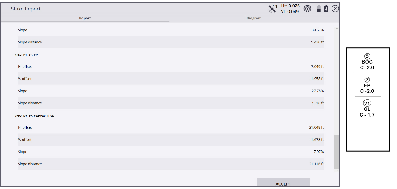
When we scroll down, we see the storyboard with offsets and cut and fill for each feature. Staking corridors allows the user to mark a cut stake with multiple offsets and cut and fills in one step.
Stake Points at Key Locations
Stake tangent points will allow the user to stake the stations at the point of curvature and point of tangent along the corridor. Optionally, the user can stake the vertical point intersections of the vertical profile of the corridor.
Key Benefits Using Siteworks and VCL Files
- VCL files exported from Trimble Business Center can contain multiple data types in one file.
- Siteworks is the only controller software that supports VCL files, SCS900 does not.
- The user has different surface options for staking a corridor.
- Example: you may have a surface for finish grade and a different surface for sub-grade.
- VCL files work well for projects that have varying sub-grade depths along a corridor.
- VCL can contain multiple corridors in one design.
- A user can stake any corridor without needing to change designs.
- Earthworks equipped machines can use the same VCL for grade control.
- You only need one file for both Site Positioning and Grade Control.