Light detection and ranging (LiDAR) technology has changed how we perceive and interact with the environment through exceptional accuracy in mapping and measuring. In some cases, integrating LiDAR sensors with drones has enabled crews to reduce weeks of rigorous fieldwork into only a few hours. This technology is one of the most important advancements in surveying over the past several decades.
The demand for LiDAR-equipped drones continues to increase across various industries as businesses recognize their ability to reduce costs while delivering superior data quality. From agriculture and construction to mining and quarrying, these solutions have become critical tools for organizations wanting to stay on pace with the competition.
JUMP TO SECTION
How LiDAR-Equipped Drones Work
LiDAR works by emitting laser pulses to the ground or toward an object and calculating the time it takes for those pulses to return to the sensor. These millisecond measurements create precise distance calculations, allowing the system to generate detailed 3D point clouds of the scanned environment with accuracy down to a centimeter. Many of today’s LiDAR systems can send out hundreds of thousands of pulses per second, creating datasets that capture each detail of what’s below.
The LiDAR sensor has a laser emitter, receiver, scanning mechanism and numerous processing components that work together to collect and interpret return signals. Advanced algorithms filter and classify these signals, distinguishing between ground points, vegetation, buildings and other features. This analysis transforms raw point clouds into usable data, allowing users to view specific features or measurements based on their application needs.
Drones work perfectly with LiDAR technology because they provide stable flight paths at optimal altitudes for data collection. With their ability to fly, LiDAR-equipped drones can see over obstacles that block ground-based scanning systems. Additionally, drones can safely access hazardous or hard-to-reach areas, opening new doors for LiDAR applications in disaster zones and other challenging environments.
Capabilities
The primary capabilities of LiDAR drones include:
- Vertical accuracy: LiDAR technology typically achieves accuracy down to 3 to 5 centimeters in most conditions.
- Mapping through vegetation: LiDAR sensors can map the ground surface beneath trees and brush, delivering accurate data in dense areas where cameras can only see the top of the growth.
- Flexible operation: LiDAR systems can operate at dawn, dusk and overcast days when conventional cameras are impractical because of poor lighting.
- High data density: LiDAR sensors can collect hundreds of points per square meter, capturing fine details that outdated surveying methods would miss.
LiDAR Drone Benefits
LiDAR drones have changed the way companies map and measure land. Surveying teams can now collect more detailed information much faster and more accurately with fewer personnel. The speed and efficiency translate to significant cost savings and faster project completion for various applications.
Additional benefits include:
- Time savings: Projects that once took weeks of field surveying can now be completed in days. This efficiency extends to processing, where the software turns raw information into useful data in a fraction of the time it would take a human to do. This boost in productivity leads to increased cost savings over outdated equipment and manual data processing.
- Increased accessibility: LiDAR drones can safely map unstable slopes, contaminated sites, busy construction zones and other dangerous areas without putting workers in harm’s way. The drones can also reach dense forests, thick vegetation, wetlands and other places that are challenging to access on foot. This increased accessibility allows surveyors to document areas that were previously impossible to map with traditional methods.
- Enhanced decision-making: Many LiDAR drone systems enable users to view data while in the field, helping them make sure they capture everything they need before leaving the site. This immediate feedback helps pinpoint areas that need closer inspection and saves time by avoiding return trips.
- Decreased labor: Drones can replace large survey teams with small crews of just one or two technicians. Additionally, drones can fly the same flight path on different days, allowing crews to track changes across a site over time.
Industries Using LiDAR Drones
LiDAR drones drive innovation across various industries, with each field finding multiple ways to use the technology daily. These systems can achieve what was previously impossible, from measuring crop growth in fields to assessing disaster areas in seconds. As LiDAR drones become more affordable and user-friendly, more industries are discovering how these devices can help solve their mapping challenges.
Agriculture
Modern farming has embraced LiDAR drones as key tools for improving agricultural operations and increasing crop yields. These systems create detailed land models showing small elevation changes that affect water drainage and soil moisture across fields.
Farmers use LiDAR to measure plant height, density and structure while mapping irrigation systems and finding areas that need improvement. This information helps farming crews apply water, fertilizer and other resources more precisely to reduce waste and improve harvests.
Construction
The construction industry has seen some of the most significant benefits from LiDAR drones. Before construction begins, site surveys provide a detailed overview of existing conditions and identify potential problems early. During construction, regular drone flights allow precise measurement of earthmoving work to confirm that the progress matches the original design plans.
LiDAR is also ideal for documenting completed work and creating detailed records that are beneficial for maintenance and site modifications.
Mining and Quarrying
Open-pit mines and quarries are perfect settings for drones. Regular volume surveys of material piles and excavation areas provide accurate inventory management without disrupting operations or putting workers at risk. LiDAR data helps analyze slope stability by detecting small ground movements that might signal potential collapses, allowing crews to take action before major failures occur.
The technology also improves exploration by identifying geological features and helping determine the best drilling locations.
Forestry and Environmental Management
LiDAR’s ability to see through tree cover makes it especially valuable for forestry applications where ground measurements are otherwise challenging. Forest managers use drone LiDAR to accurately measure tree heights, crown sizes and forest density without time-consuming fieldwork. Conservation efforts benefit from detailed habitat mapping that identifies important micro-environments and tracks changes in forest structure over time.
Environmental studies use the technology to measure biomass, track carbon storage and determine how different management practices or natural events affect a forest.
Urban Planning
Cities worldwide leverage LiDAR drone data to build detailed digital models that help plan, manage and simulate urban environments. These 3D models create powerful visualization and analysis tools for planners and community members by mapping buildings, infrastructure, vegetation and terrain.
Utility workers use LiDAR to document the exact location and condition of aboveground infrastructure while helping plan more efficient placement of new services. City planners use the elevation data to study heat patterns, predict flooding and preserve scenic views.
Disaster Response and Recovery
When natural disasters strike, LiDAR-equipped drones provide fast insight that guides emergency response efforts and saves lives. These systems can rapidly assess structural damage after earthquakes or storms and identify damaged buildings that pose ongoing risks to victims and first responders.
Drones show emergency teams exactly where flooding will occur, allowing them to plan evacuations by identifying which areas may be in danger. During wildfires, LiDAR indicates exactly where the fire is burning and where firefighters might be able to stop the fire’s spread. Once extinguished, the data reveals the effects of the fire and tracks how well the area recovers over time.
LiDAR Drone Solutions From SITECH Southwest
The staff at SITECH Southwest can evaluate your application to help you find the best-suited mapping drones and tools. As the leading technology solutions provider across Arizona, Nevada, and Southeast California, we offer industry-leading drones from Autel, DJI Enterprise and Wingtra. We provide a full range of support and services, from initial consultation and product selection to operator training and ongoing technical support.
Our unmanned aerial vehicle (UAV) offerings include:
Drones
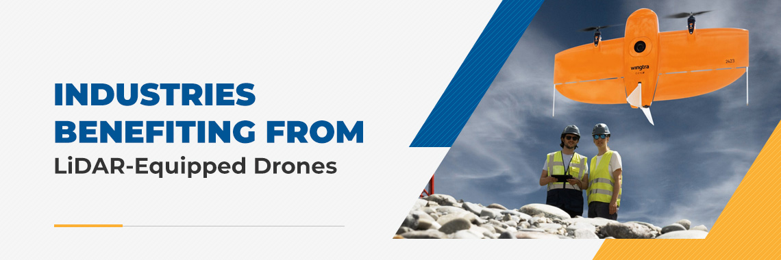
The WingtraOne GEN II represents the best in fixed-wing mapping drone technology. This innovative vertical take-off and landing (VTOL) platform offers the advantages of fixed-wing aircraft and multirotor drones. With the ability to fly up to 36 miles per hour, the WingtraOne GEN II can cover large areas in a single flight while landing safely in tight spaces or on rough terrain.
DJI’s Mavic 3 Enterprise and Matrice 350 offer industry-leading quad-copter UAV technology that provides a variety of payloads — from photogrammetry cameras and LiDAR scanners to emergency lighting and hybrid, multipurpose payloads — that combine multiple technologies for various advanced applications.
Autel Robotics is another innovative drone manufacturer and leader in aerial technology. The EVO II Pro and EVO II Dual showcase the company’s passion for technology and position Autel among the best on the market.
Payloads
A drone payload is the weight or cargo a drone carries beyond its own structure and essential components. It can include cameras, sensors, delivery packages, or specialized equipment for tasks like spraying or scientific research.
Wingtra and DJI offer advanced camera and LiDAR payloads, which are designed for all types of applications, from standard color cameras that capture detailed images to specialized devices that use multiple light wavelengths. These payloads help create 3D models, index maps, point clouds and more.
LiDAR technology sensors create highly accurate 3D models of the land that show details that are impossible to capture with standard mapping methods. These systems work well for many industries, including agriculture, construction and environmental monitoring, where traditional cameras cannot see the ground.
While Wingtra and DJI offer more advanced LiDAR options and a variety of camera payloads, Autel drones feature impressive 8K camera resolution, as well as thermal imaging capabilities, making them suitable for various industries, including survey mapping, security and search-and-rescue applications.
Request More Information About Our Drone Mapping Technology
Take your mapping capabilities to new heights by choosing SITECH Southwest for LiDAR drone solutions. Our experts are excited to help you select the ideal equipment setup for your application and budget. Contact us online or call 602-437-0410 today to schedule a demonstration and learn how our products and services can drive success for your business.