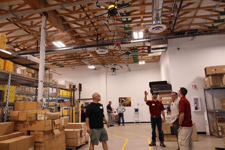
Here at SITECH Southwest, we have a museum of drones hanging from our ceiling. It all starts at the door. As you walk from the front to the back, drones are ordered from old to new. Entering you will see larger, older, more complex, more expensive, and Ph.D. required drones. And as you walk toward the back of the building you will notice an evolution, ending with the newest drones on the market.
These ones are easier to fly, less expensive, and include new abilities for consistent and accurate results. They really do outperform older drones in every way.
The survey and mapping drone industry has been a fast-moving business to keep up with, but we have paid our dues, and thus gained a lot of expertise. We have years of knowledge from working with multiple companies and providing them with solutions. Over the years we have worked hard to be one of the most experienced mapping and survey drone vendors in North America, if not the world. Today, we are presenting the next generation of drones, providing the latest data-sharing solutions, and inviting potential clients to get started with SITECH for a more successful flight.

JUMP TO SECTION
How WingtraOne GEN II is Exceeding Expectations
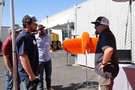
Our team works diligently to provide solid and easy-to-use products for our clients. Our top seller is the WingtraOne GEN II fixed-wing drone. Its ease of use, consistent accuracy, and ability to fly almost anywhere makes this drone a winner. We have many clients replacing their multi-rotor drones with this fixed-wing, allowing for easy flight and larger mission area coverage. The WingtraOne GEN II increases the flight time to around an hour compared to a multi-rotor getting around 20 minutes of flight time. The other key ability for this fixed-wing is Vertical Take Off and Landing (VTOL).
This fixed-wing drone takes off vertically like a multi-rotor and then transitions into forward flight like an airplane. It does the same in reverse for landing and can do this in very windy conditions. Our team has tested it in over 25 mph winds without a single problem. Watch the latest Wingtra drone in action – pairing perfectly with mapping and surveying solutions after and during the flight.
Trimble Partnership Makes Sharing Data Easier
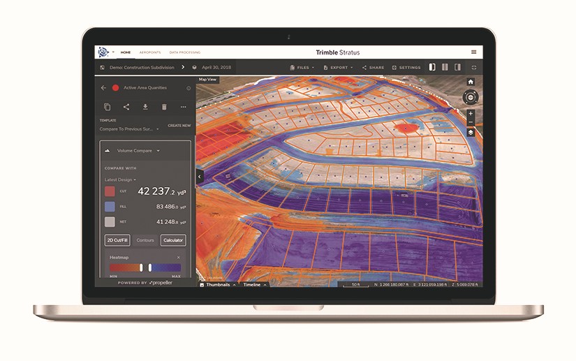
Wingtra & Trimble Stratus make an effective team. Trimble Stratus is an online processing solution that takes your photos and flight logs from the drone and turns them into point clouds and contours. Wingtra has a fully automated workflow with the Trimble Stratus online service. It makes processing and sharing your data an easy and straightforward procedure. Mining is just one example of where sharing data immediately can make integrated teams more efficient.
 A Better Way to Integrate Data in the Mines
In utilizing Wingtra and Trimble Stratus together we are changing the way mines manage their daily engineering. In big copper mines, the ground changes daily. Keeping updated maps in the engineer’s hands has always been a struggle. Now, with Trimble Stratus updating the maps daily, data is available to engineers and the entire mining team.
Everybody from the mine manager to the drill, blasting and the contractor on site, can all share these large data sets with daily metrics on production. The current topography overlaid on updated plans can easily be downloaded into any CAD, GIS, or planning software. At SITECH Southwest, we have helped implement this technology through consulting, sales, and training – giving us more opportunities to see our clients thrive.

Take Flight with SITECH Southwest and Wingtra
SITECH Southwest is your local flight and drone expert providing quality technology, software, and Wingtra products in Arizona, Nevada, and parts of Eastern and Southeastern California.
We look to exceed expectations and provide the best for our clients. If you would like to see how our drone mapping program can change your business, contact us today and learn more about all our drone offerings and demo opportunities!

 A Better Way to Integrate Data in the Mines