Often the most misunderstood but probably the most powerful use for flying drones is survey and mapping. Additionally, if you were to pick the perfect place to use UAV technology it would be a mine as drones allow you to cover larger areas of earth that are constantly changing.
Now consider the fact that the industry is continually evolving. The timing has never been better for adding a drone to your survey department. Let us break down how a drone could help your mine with some basic concepts.
JUMP TO SECTION
 Choosing the right drone for you
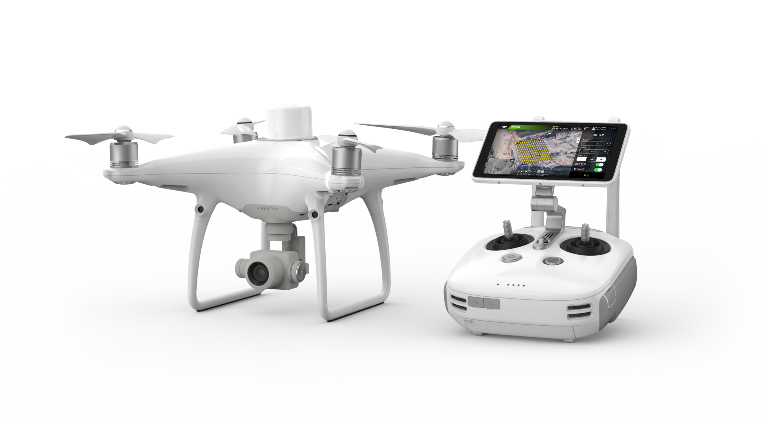
If you’re in need of mapping capabilities, our best-selling mapping drone is the DJI Phantom 4RTK. We use it in conjunction with Trimble Stratus for data processing. It’s easy to fly, simple to process data and provides consistent results. Plus, the price point for this type of package is below what you’re currently spending on traditional survey equipment.
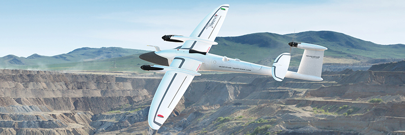
If you’re in need a long flight time for a large area, another very popular drone is the Quantum Trinity F90+ fixed wing. With a flight time of 90-minutes this drone can fly mass land areas, up to 1700 acres per flight.
How surveying a mine with a drone works
Mapping drones use high precision GPS to precisely locate their position as they take photos flying high above a mine site. The pictures the drone takes overlap front to back and side to side by as much as 80%. In doing this, the ground is covered with multiple overlapping scalable pixels. These pixels become the measuring units. Essentially, we are covering the ground with measurable little boxes as if we wrapped the mine in graph paper. The result is a 3D map with accuracies around +/- one-tenth foot.
 The impact of mine planning and survey data
Drone mapping has changed how the whole engineering process works.
First, it provides complete survey coverage of an area by processing aerial images into a 3D model.
Second, the accuracy and detail is far more superior. Compared to traditional survey methods, it’s a night and day difference. An example would be looking at poly lines versus an updated Google earth type 3D model.
Lastly, shareability and ease of use is one of most valuable reasons for using drone technology. The data is hosted inside a browser that can be shared anywhere and anyplace. From the field to corporate planning to including a contractor in the process, all this can be done anywhere in the world as it is needed.