GNSS (Global Navigation Satellite System) works by satellites, that send out signals to receivers on Earth. GPS (Global Positioning System) is one component of the Global Navigation Satellite System and refers to the NAVSTAR Global Positioning System. GNSS is used in collaboration with GPS systems that carry atomic clocks for accurate time to show when satellites send signals, allowing the receivers to compute their position. Trimble GNSS receivers utilize the five current satellite constellations, GPS (US) QZSS (Japan), BEIDOU (China), GALILEO (EU), and GLONASS (Russia). Using all five constellations results in faster more accurate positioning, even in hostile environments.
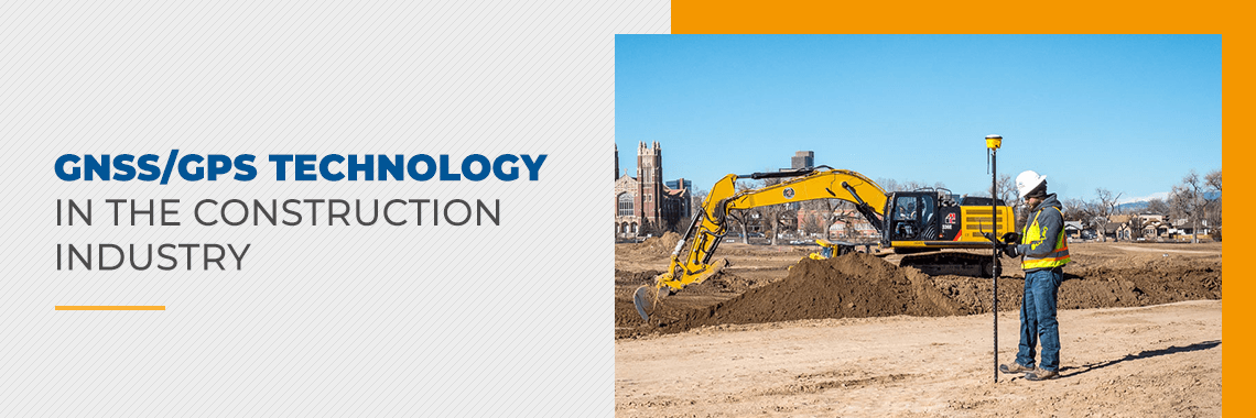
GNSS/GPS technology uses in the construction industry include organizing sites, keeping track of equipment, surveying, grading, excavating, drilling, pile driving, and compacting.
JUMP TO SECTION
Construction Applications of GNSS/GPS
Applications of GNSS/GPS in the construction industry can help contractors more efficiently and accurately complete projects, especially those that are larger-scale and would traditionally require larger crews. While helpful in completing jobs, GNSS/GPS is also critical for organizing your construction site, including locating and tracking equipment, surveying sites, ensuring maximum safety, and reporting on worker progress.
While both GNSS and GPS are used in the construction industry to refer to geolocation, GNSS is becoming the more commonly used term and will be used for the remainder of this article.
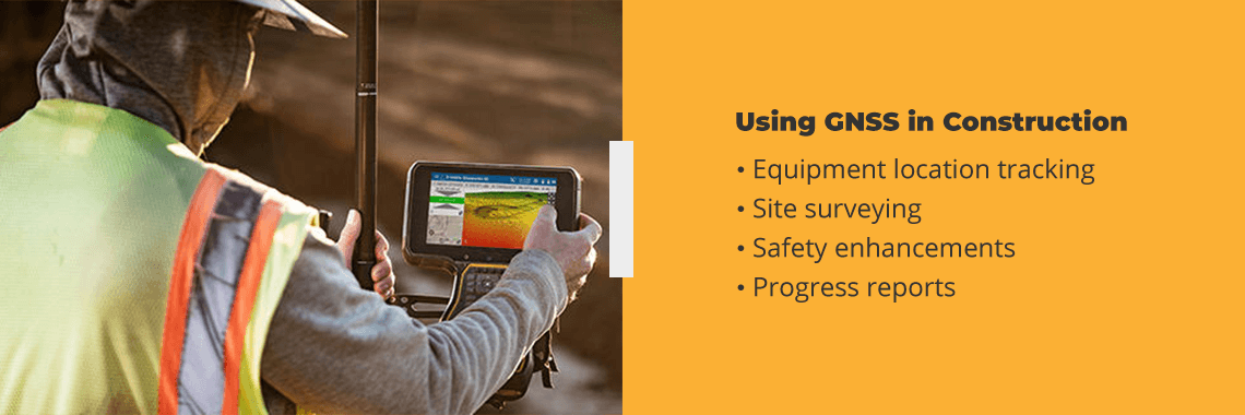
Using GNSS in Construction
Some of the places GNSS is particularly useful in construction include:
- Equipment location tracking: Knowing where all construction vehicles are on a large site is crucial for streamlining efficiency and productivity. Workers at a particular section of the site can quickly acquire the machines they need. Further, fleet tracking is a common use of GNSS in the construction industry. Construction workers can understand which routes are fastest to maximize fuel efficiency and avoid congestion by seeing how fast vehicles are moving. You can keep track of expensive equipment to ensure it’s not lost or stolen as well.
- Site surveying: Surveying a site is crucial before construction crews even begin work on a location. Trained teams typically must use specialized measuring tools for grading, elevation and mapping the area. However, GNSS improves and streamlines the surveying process, as 3D-measurement tools increase survey accuracy. With a more efficient and precise surveying process, construction crews can start work much sooner. GNSS also only requires one person to be on-site for surveying since it is quick and easy to calculate each point.
- Safety enhancements: Because construction is a dangerous job, you can prevent tragedy, OSHA fines, lawsuits or worker’s compensation costs with proper safety enhancements. GNSS can help you know when to service construction equipment, including odometer ratings and when to conduct routine maintenance such as tire rotations or oil changes. GNSS technology also can track how safely crews drive, minimizing workplace accidents and maximizing fuel efficiency. Aside from ensuring employees drive safely, GNSS can give hazard notifications and provide employees with emergency buttons as well.
- Progress reports: Although managers typically give time estimates for how long a particular job will take, GNSS can help managers track productivity by monitoring when workers take longer than expected with a task and recording when equipment and vehicles move on a site. Geotagged photos can also help you see the time, date, latitude and longitude for a particular location.
GNSS Highway Construction Equipment
Highway grading and paving is a large-scale construction process that typically takes a long time and requires large survey teams. The expansiveness of these jobs usually makes them more expensive. GNSS highway construction equipment and their uses include control systems for grading, paving and asphalt compaction.
The Trimble PCS900 3D Paving Control System bases paving on a 3D model to pave various depths and slopes. The system allows teams to remove high and low areas early in the process, saving time and money. It also helps teams lay complicated designs and achieve greater accuracy and smoothness with less asphalt. What’s more is that workers don’t have to lay string lines, a costly and time-consuming process, but can now use the more advanced curb and gutter technology with auto-steer and grade.
Trimble’s CCS900 Compaction Control System is made for more efficient, improved asphalt compaction operations. The system monitors and manages the number of passes to help ensure proper asphalt thickness, preventing under- or over-compaction. Your team will also more effectively communicate by seeing the work other compactors are doing in real-time. Knowing what other team members are doing achieves better surface quality and saves fuel. Further, workers in the field can easily transfer compaction data to the office.
Supervisors and managers can also monitor contractors’ work with the optional in-cab printer or web-based software. Supervisors can see pass counts and meter values, monitor temperature maps, reduce rework and optimize fuel use.
GNSS Technology Uses in Construction
Modern machine control systems offer 3D GNSS tracking of a job site. GNSS increases machine positioning accuracy and automatically guides equipment according to the project plans. Two major GNSS technology uses include grade control and machine control. More specific applications of GNSS in the construction industry include excavating, paving, piling, compacting, drilling, dozing and scraping.
Fitting equipment with GNSS, training operators and making the GNSS-based model is much less expensive than the manual labor required for traditional sites. The cost of employing GNSS on a site equates to the price of hiring a survey crew for the first year of a project. Additionally, having a base station for each site reduces transmission errors, directly linking to satellites and giving operators a clear picture of what’s happening on job sites.
SITECH Southwest offers surveying software like Trimble Siteworks for GNSS surveying, allowing contractors to quickly and accurately compare 3D models and collect large sets of data. The system includes the Trimble SPS986 Smart Antenna with tilt compensation for a precise GNSS/GNSS rover, which is especially useful for surveying hard-to-reach areas. It connects through Bluetooth, includes an internal radio and includes 440 satellite channels for high precision.
Especially useful for complex or large-scale excavation or grading, the Trimble GCS900 dual GNSS grade control system allows for the most accurate cross slope and blade positioning if used along with Trimble Earthworks. Workers can see real-time cut and fill indications and manage auto blade control as displayed in-cab, heightening safety while reducing project completion time. Trimble’s GradeMax technology is equipped in all of SITECH Southwest’s dozer systems for precise grading.
GNSS for construction can also help workers know a job site’s location and reveal the most efficient routes for employees when traveling between places to save time and fuel.
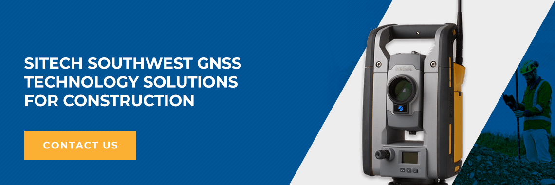
SITECH Southwest GNSS Technology Solutions for Construction
SITECH Southwest is Arizona, Nevada, and Southeast California’s leading technology solutions provider for the construction, mining, agriculture, and landfill industries. We are an authorized dealer for Trimble, Caterpillar and Spectra Precision products that include:
- Machine control
- Grade monitoring
- Site positioning systems
- Construction software solutions
Our technology is fully interchangeable and able to adapt to any machine regardless of its make or model.
Beyond equipment, we offer training in topics like grade checking, site management, road modeling and machine control to take your team’s skills to the next level. We also have a fully equipped service center to maximize the reliability of your equipment. Our experienced factory-trained, certified service technicians offer preventative maintenance, certification services, repairs and equipment upgrades. Contact SITECH Southwest today or browse our product catalog to learn more about our GNSS solutions for the construction industry!