JUMP TO SECTION
The basics of dealing with coordinate systems.
I conduct a lot of survey training for construction and mining clients. In every class I usually start off with a “Coordinate Systems 101” lesson. This is something most clients struggle with. I find that there are a lot of people running GPS survey and machine control systems that may not have a basic understanding for how the coordinate systems relate to their jobsites. There are also experienced surveyors that tend to make these topics overly complex for most people trying to understand the basics. Here are some basic coordinate system rules for clarity.
One coordinate system applies to the whole world!
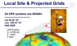 There is an internationally recognized coordinate system for Earth. It is called the International Terrestrial Reference Frame or ITRF. Global Latitude and Longitude coordinates (WGS84) are based off this. This is used all around the world. Google Earth maps your Garmin and especially your machine control and survey systems. This is all any GPS knows, global coordinates!
Why is this important?
Having one global reference frame (WGS84) makes it easier to convert between localized and other older projections. It means we have one system in common with all other projections. Since the 3rd Century BC, when Eratosthenes first invented the geographic coordinate system, every small country in the world has developed their own ellipsoidal projections. We can now convert between any of those projections, as well your local mine or construction site. In Trimble Business Center it is as easy as just changing the coordinate system. It reprojects from global to whatever you ask it.
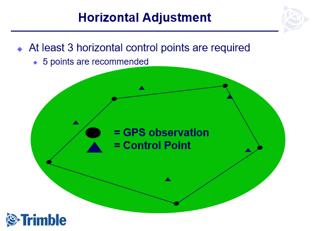
Create your own projected to match any grid!
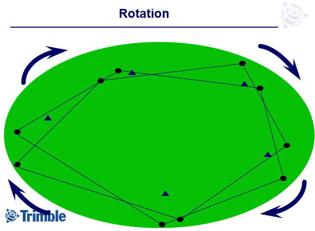
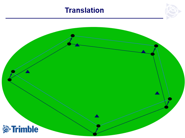
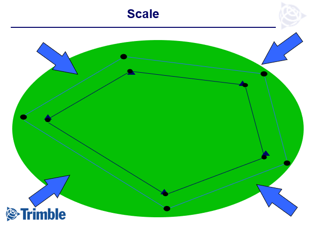
If we take five points with north east and elevation, then we go measure the latitude, longitude, and ellipsoidal height for the same five points, we can then create our own projection. In doing this, we can conform our high precision GPS to match most any pre-existing survey. All Trimble Survey and GIS systems have a calibration program to facilitate this. Rather than try and match an existing projection with scale and rotation factors, it’s much easier and usually more precise, to just calibrate to the existing control points. In doing so we are going from a global coordinate to a projected survey that matches existing points. Are you going out to match a DOT job? Calibrate! Are you going out to match an old mining grid from the 1800’s? Calibrate! Do you need to set up on a UTM grid? Calibrate! Calibrating will scale, rotate and smooth out inconsistencies from other surveys.