Several methods are available for construction surveying, from photogrammetry to traditional surveying to LiDAR, the latter of which has been increasing in popularity in recent years. Invented in the 1960s, LiDAR has quickly become a prominent technology in many industries, including construction, city planning and scientific research. But what is LiDAR, and how can you use it on your construction site? Read on to find out.
JUMP TO SECTION
What Is LiDAR?
LiDAR, which became commercially available in the ’90s, is a widely used laser technology that uses light to create 3D models of areas and structures. The term LiDAR is an acronym for “Light Detection and Ranging.” Essentially, it’s a way of using low-frequency light beams to map out an area. LiDAR is also sometimes referred to as laser scanning or 3D scanning.
It’s similar to radar, which stands for “Radio Detection and Ranging” and uses soundwaves to create 3D models. While the two are similar in nature, LiDAR tends to be more accurate than radar, which is less capable of determining the shapes of objects.
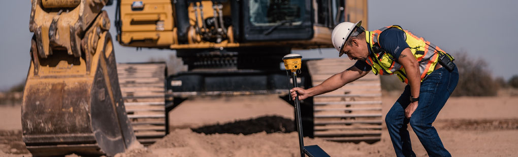
A LiDAR system usually consists of three parts:
- A laser
- A scanner
- A GPS receiver
LiDAR scans are usually conducted in the air using drones, planes or helicopters, but some applications require LiDAR to work underwater to measure riverbed or seafloor elevations. Other common applications for LiDAR include planning remodeling or renovation projects, exploring uncharted territory, city planning and even providing “sight” to self-driving cars.
Here’s how LiDAR works:
- The scanner fires tiny pulses of light at a speed of up to 1 million pulses per second.
- Each pulse point strikes the closest object and bounces back to the scanner.
- The scanner calculates the distance between itself and the object based on the speed of the light returning to it.
- Once the scan is complete, the LiDAR catalogs and processes all of the points as a point cloud, which produces a detailed 3D model of the structure or space.
- For especially complex or large structures, you might need to repeat the process and stitch together the resulting models in a process called registration.
As the use of LiDAR has increased in various industries, it’s also become more accessible. While still a considerable investment for any construction company, LiDAR has decreased in price over the years, and will likely continue to do so in the future.
How Does LiDAR Technology Impact the Construction Industry?
This type of technology has been incredibly beneficial to the construction industry since its invention — specifically, LiDAR has become increasingly important to contractors over the past few years.
LiDAR in construction provides precise measurements and detailed site analysis, even in dense foliage. Its cloud point imagery offers accurate ground-level vegetation mapping, surpassing traditional photogrammetry. This technology aids in infrastructure planning, design accuracy, and evaluating terrain stability and flooding risks.
A construction site that employs LiDAR mapping will often use the data collected in their initial survey to create simulations of the proposed project to show to key stakeholders. These simulations are helpful for demonstrating the value of a project and reducing the chances of reworking elements later on.
Additionally, when the project is underway and construction has begun, you can use regular LiDAR scans to ensure your project is on track. This use can also help make job site inspections more convenient for you and your inspectors. By providing a LiDAR-generated simulation to an inspector, you’ll eliminate the need to physically walk an inspector through the site, enabling you to maintain high productivity levels and compliance with construction site regulations.
Benefits of LiDAR in Construction
One of the main benefits of using LiDAR in construction is that it’s an effective tool for uncovering aspects you might not notice with the naked eye alone. For that reason, LiDAR mapping can often help your team solve problems even before they arise.
This prevention benefit has numerous other advantages, including the ability to:
- Plan accurately: LiDAR enables construction workers to gain a precise vision of the work site from the outset of a project, significantly reducing the time and money needed to create a suitable building plan. Plus, a more accurate vision of your plans can help you draft the most accurate budget possible.
- Determine land stability: LiDAR survey data can create a bare-earth model of your site. This model can reveal stability issues with the land you’re building on, including potential landslide risks and unsafe slope gradients.
- Increase job site safety: LiDAR scans can reveal potentially dangerous parts of your site or structure before they become issues.
- Identify urgent renovation needs: In already existing buildings, LiDAR scanning can reveal hard-to-see structural problems that require immediate attention.
- Create models any time: Because LiDAR scanners are the source of the light beams used to measure a space, you can survey a project in light or dark, rain or shine.
- Avoid distortions: Unlike many other forms of surveying, the cloud point models produced by LiDAR mapping don’t experience distortions when faced with angular or otherwise complex shapes. Therefore, LiDAR can provide a clear image that most accurately reflects your work site’s surroundings.
Of course, proper training is a crucial step toward getting the most out of your LiDAR investment. If you plan to introduce any new technology to your site, you need to make sure your team is well-equipped to use it effectively.
Get Your LiDAR Technology From SITECH Southwest
As the leading provider of technology solutions for the mining, agriculture and construction industries in the Southwest United States, we’re proud to offer you our LiDAR and UAV solutions for DJI and Quantum products.
In addition to offering a variety of UAV solutions for the construction industry, we also provide training courses and learning events so your employees can learn how best to use their technology. After all, we’re dedicated to making every operator a great operator.
If you’re ready to get started, you can browse our UAV solutions. Do you still have questions about our products and services? Feel free to contact us online. A team member will respond shortly to help you find answers.