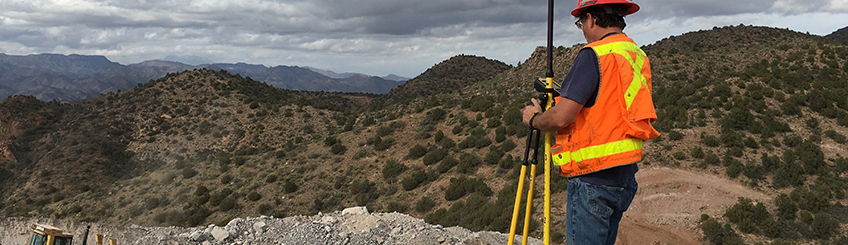
If you are reading this, you are probably a high-end user doing surveys and machine control. The focus for this article is show how Modernization of the GNSS system is affecting your job site. Frist we define what the differences between GPS and GNSS are and how they can benefit you.
What is GPS?
GPS stands for Global Positioning system. In a nutshell these GPS satellites broadcast radio signals at the speed of light that intersect a receiver on earth providing location. GPS is used everywhere these days from your phone, bicycle computer to your high-end survey and mapping tools.
The first working GPS satellite was launched in 1978. Then you saw a full working GPS by the mid 1980’s. GPS is a constellation of 24 by design satellites orbiting earth twice a day at around 13,000 miles (about 20921.47 km) into space. A limiting factor in the original satellites was battery technology. Radios were designed to broadcast very weak signals so the batteries would not die. This is the major reason older GPS systems are slow and difficult to get a “fixed”.
Another huge benefit from the original GPS launched back in 1978 was the ability to accurately measure the center of mass for earth. This gave us our first internationally excepted coordinate system called the ITRF. ITRF stands for International Terrestrial Reference Frame. International being a key work as the world has accepted this and is used to convert between older system. This gives us a common conversion to go between projections. For the most part, you hear people refer to the ITRF as “Global Coordinates” which we convert to Latitude and longitude for ease of use.
Today this US GPS system named Navstar has around 31 working satellites with newer battery technology putting out more frequencies at higher power.
What is GNSS?
Global Navigation Satellite Systems. GNSS is plural. GPS is singular. GPS is for one system and GNSS is for multiple systems. Today we have many GPS systems from many different countries around the world that make up the complete GNSS. To name a few;
- GPS Navstar US
- QZSS Japan
- BEIDOU 1,2,3 China
- Galileo Europen Space agency
- GLONASS Russia
On any newer Trimble GPS survey system, you will find a fully functioning GNSS capable receiver. That means it works with any one of the GPS systems that make up the complete GNSS. Back in 2000 there were 40 GNSS satellites between all the GNSS. Today there are over 100 satellites in the GNSS. As technology improves there have been some major updates to the capability of your survey system.
What are the improvements being seen today with Modernized GNSS?
Any new Trimble system going out the door today is equipped with a full functioning GNSS ability. Some of the major new abilities include:
New Civil Radio Signals
Galileo (European) and Navistar (US) have updated radio signals that are much stronger and have been designed to work together. Back in 2004 the US signed an agreement with the European Space Agency to collaborate on the design for the new radio signals. As I write this, your best strongest GPS signals are coming from Galileo and Navistar.
L1c, L5 and L2c are the new navigation signals enhancing the legacy civil signals called L1 and L2. As new satellites come online, you are noticing that you are getting coverage in more places than ever before. Up against buildings, down in open pit mines, under trees, even harsh urban environments, you are now able to use your GNSS survey systems. Not only the stronger signals are helping, but also because the signals are coming from so many different system timing issues are now solvable.
GNSS: Triple-frequency
One of the major components of the modernized GNSS is Triple-frequency observations for high-accuracy positioning. This has been in development for years but now is a working part of the GNSS. Getting three different signals from multiple systems allows for better solutions by canceling out errors from singular or dual frequency systems. As radio signals enter earth’s atmosphere the radios signals run into ionosphere which has a timing effect on the signals. Using Triple-frequency we can eliminate a lot of the errors by improving accuracy.
What you need to know about your job site or mine and how GNSS modernization is affecting it:
GPS/GNSS systems are computers and just like any other computer it needs updates to stay current. Your GPS/GNSS equipment is only half the system. The other half of the system are the satellites in space. Modernization is bringing many updates to the GNSS satellites. You need to make sure half is getting its updates. Contact your SITECH rep to check your base and rover.
- Any new systems should be fully GNSS enabled.
- Newer GNSS rovers and machine controls will not see the benefit if your base station is not updated.
- Many cases a newer base station only requires firmware updates while an older base station and antenna may need to replace.
- With new GNSS base and rover combinations you can expect to see quicker initializations, coverage in areas that are downright unbelievable and reliable – a quick easy working system.