Sodex Innovations transforms any piece of construction equipment into an automated surveying tool. By eliminating the need for dedicated survey crews, the technology eliminates project delays caused by traditional surveying methods.
The SDX-Compact utilizes LiDAR and GPS positioning technology to deliver real-time, streamlined data collection. While the equipment is operating, the system continuously scans the surrounding terrain, uploading topographic data wirelessly to the cloud every 10 minutes.
Experience the immediate value of automatic construction site digitization — the tool captures your construction site’s conditions without interrupting your team’s workflow. While your operators continue to focus on their work, Sodex handles surveying tasks to provide an accurate record of site progress and changes in terrain.
Digitize Your Site Automatically
Your Sodex equipment captures a live point cloud while working. An up-to-date model of the site is available for review almost immediately on the web.
Import your data into any CAD-based program, like Trimble Business Center or the SDX-Cloud service to analyze, measure and monitor your site with precision.
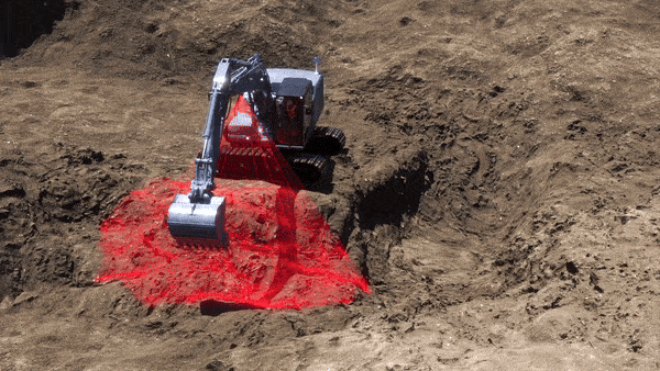
Earthmoving
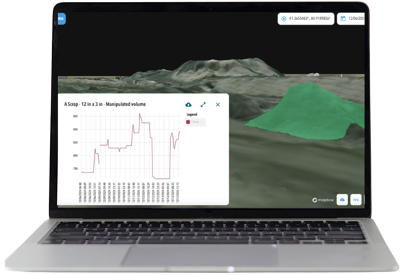
The SDX-Compact mounted on your dozer automatically surveys the terrain around it, providing real-time as-built information, as well as the current status of the project. Monitor cut and fill volumes throughout the day, compare current conditions against design models and identify variances before they become costly problems.
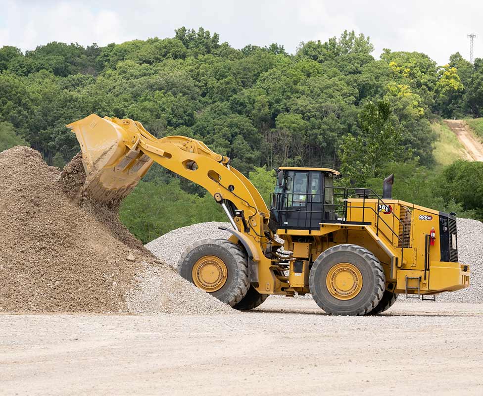
Aggregates
Automate stockpile monitoring with the SDX-Compact mounted on your loader. Your equipment scans the terrain while working, detecting any changes and uploading them to the cloud. The SDX-Compact can calculate accurate inventory volumes without manual surveys, enabling better material management and more precise customer billing.
Pipeline Construction
Highly accurate, colored point-cloud data provides immediate as-built details about your project. Automated data acquisition and documentation is a huge competitive advantage. Verify trench depths, slope compliance and backfill progress with survey-grade accuracy throughout each phase of your pipeline project.
SDX-Cloud from Sodex is a powerful software platform designed for you to manage, record, and share information about your site effortlessly.
Collect and combine information from multiple surveying devices, including: SDX systems, drones, UAVs, GNSS, LiDAR and phone scanners. However you collect your site data, SDX-Cloud ensures smooth integration.
Expert Support for Sodex Innovations
SITECH Southwest provides comprehensive training and support for all Sodex solutions. Our technicians understand how the surveying integrates with your broader technology ecosystem, from equipment control systems to project management software.
We help you provide a seamless rollout for Sodex Innovations with hands-on training, ongoing technical support and system optimization. Partner with us for solutions tailored to your specific applications across Arizona and Southeastern California.
At SITECH Southwest, we’re excited to offer Sodex solutions to our clients!
Call us at 602-437-0410 to speak directly with a member of our team to arrange a product demo.
Contact Us
Talk to an expert at SITECH Southwest about integrating Sodex solutions into your project.
SITECH Southwest continues to proudly hold its position as the premier technology solutions provider for the Construction, Mining, Agriculture, Landfill, and Quarry & Aggregates industries. With unwavering commitment, we offer our exceptional services to Arizona, Nevada, and Southeast California, solidifying our reputation as the trusted leader in these regions.
Contact us at one of our convenient locations below to get started.