Autonomous Data Mapping For GPS-Denied Environments
SITECH is an authorized dealer of Emesent Technology, an autonomous SLAM-based LiDAR mapping and data analytics solutions for challenging and GPS-denied environments, utilizing expertise in Robotics, Autonomy, AI, Machine Learning, and Data Analytics to create innovative technologies for the future of autonomous industrial assets.
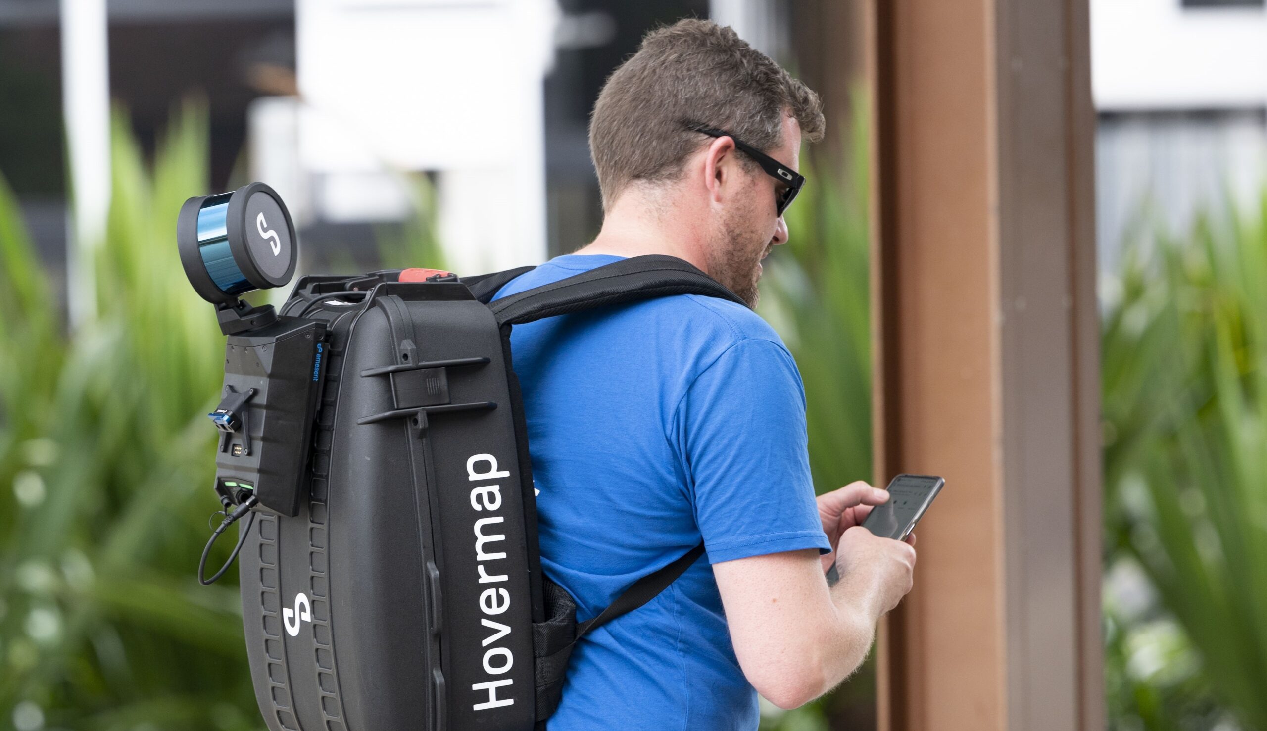
At the heart of Emesent’s offerings is the award-winning Hovermap™. This advanced technology provides scanning, data-capture, and visualization capabilities that meet the rigorous demands of mining, engineering, and public safety industries. Emesent collaborates closely with customers to drive smarter decision-making and uncover deeper operational insights, ultimately enhancing efficiency and safety across various sectors.
Hovermap
CLICK TO VIEW SPECS
![]()
![]()
AUTONOMOUS DATA
![]()
![]()
WEATHER RESISTANT

LIVE-STREAMED DATA

WIDER MAPPING RANGE
![]()
![]()
HIGHER SENSING RANGE
Fill out the form below to speak with our team to learn more or schedule a demo.
Utilize Emesent In Your Industry
Mining
Emesent pioneered the use of autonomous drones in underground stope mapping, ensuring a safer and more efficient mapping workflow than previous techniques. Now extending to other applications in mining, including capturing Digital Twins, Hovermap is essential to providing operational insights at some of the biggest mines worldwide.
Offering a uniquely versatile mine mapping solution, Hovermap can be deployed on a drone to provide autonomous mapping in stopes and vertical shafts, convergence monitoring in drifts, evaluation of new blast designs, and an accurate, up-to-date picture of inaccessible areas. It can also be used as a vehicle mounted scanner to capture drives or lowered down raises and overpasses in a cage.
Learn how Emesent Hovermap technology helped Evolution Mining improve its stope design and reconciliation process at Mungari gold mine. Read case study>
Engineering & Construction
Keep your projects on track with fast, safe, and flexible data collection using Hovermap, a smart LiDAR scanning unit. The mobile scanner enables data capture up to seven times faster than traditional
methods.
Use Hovermap to produce accurate and dense data that can be easily processed into project deliverables. Capture high resolution, true-color point clouds to create digital twins of any assets such as bridges, buildings, communications towers, tunnels, and many more. Fast and easily repeatable scans allow you to verify construction and identify potential issues early to reduce rework, helping to keep your project on track and within budget.
Geospatial
Hovermap collects detailed, accurate and georeferenced data, enabling advanced geospatial analytics and offering greater insights quickly. Featuring unique – and industry leading – versatility, Hovermap can be deployed via drone, backpack, or handheld modes, enabling data capture across multiple and typically challenging environments.
Emesent Automated Ground Control Points for drone deployment increase accuracy and can eliminate drift and slip. Automated georeferencing and streamlined workflows accelerate efficiency, from scan to output, by removing manual and potentially error-prone tasks.