
Loading and moving materials on your construction site requires precision. You need to follow specific payload weight and distribution guidelines based on your equipment and the materials you transport to ensure safe, productive project completion.
Loading and moving materials on your construction site requires precision. You need to follow specific payload weight and distribution guidelines based on your equipment and the materials you transport to ensure safe, productive project completion.
The R750 is not only a direct replacement for the SPS85x series of receivers, but also comes with useful upgrades making it a versatile tool. As typical with a new product, out with the old; the SPS855 has been discontinued and is no longer available. The good news is the R750 uses the same antennas and data cables besides offering many new enhancements.
Trimble Navigation, founded in 1978 by Charles Trimble, was developed to provide technology to the survey and GIS industries. Sometime in the late 90’s, Trimble started bolting survey hardware onto heavy machines, like bulldozers and excavators, forcing operators to understand surveying principles.
Several methods are available for construction surveying, from photogrammetry to traditional surveying to LiDAR, the latter of which has been increasing in popularity in recent years. Invented in the 1960s, LiDAR has quickly become a prominent technology in many industries, including construction, city planning and scientific research. But what is LiDAR, and how can you use it on your construction site? Read on to find out.
Read more
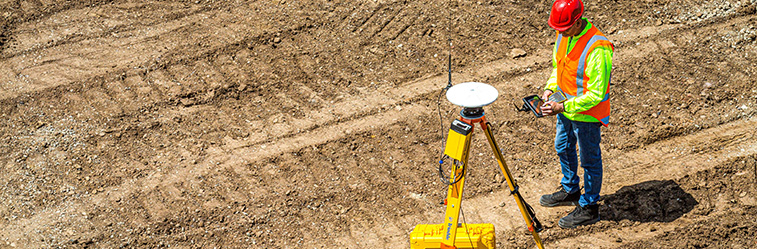
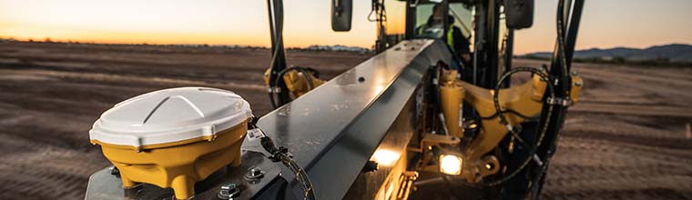
Trimble’s Real Time eXtended (RTX) correction service is a global GNSS correction source used to attain precise GNSS positioning. It operates the same as using a local base station, or Virtual Reference Station (VRS), to reduce the errors in GNSS positioning. Without corrections, a GNSS rover is only accurate to about 16 feet +/-. With corrections, GNSS rover positions are accurate to 0.02 to 0.06 feet.

GNSS (Global Navigation Satellite System) works by satellites, that send out signals to receivers on Earth. GPS (Global Positioning System) is one component of the Global Navigation Satellite System and refers to the NAVSTAR Global Positioning System. GNSS is used in collaboration with GPS systems that carry atomic clocks for accurate time to show when satellites send signals, allowing the receivers to compute their position. Trimble GNSS receivers utilize the five current satellite constellations, GPS (US) QZSS (Japan), BEIDOU (China), GALILEO (EU), and GLONASS (Russia). Using all five constellations results in faster more accurate positioning, even in hostile environments.
Read more
Two things have happened recently that will dramatically change the way your GPS rover works.
First, there are completely new GNSS capabilities from new satellites, new GPS systems, and new types of radio signals coming from space. Second, Inertial Measurement Unit (IMU) was added to the Trimble SPS survey Rover.
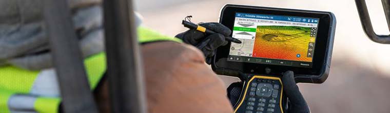
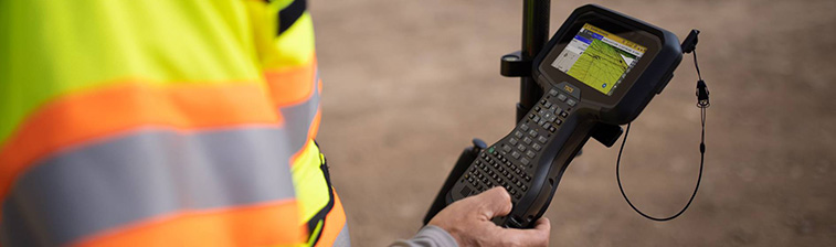
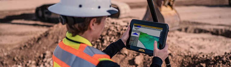
How to connect Bluetooth receivers is one of the most frequent support calls SITECH Southwest receives. The Bluetooth functionality in both Siteworks and SCS900 is managed by the Windows 10 operating system.

In this article we will take at look LiDAR for everyday use by testing a DJI L1 lens at a controlled testing site.
Simplifying your map maintenance process can relieve a lot of double work improving time, and frustration, and more importantly communication from the field to the office.