Exploring New Ways To Mine
Decades of experience in off-machine mining technology have led us to reinvent the way mining surveying professionals work. Our heavy-civil approach empowers mining engineers to easily layout sites, communicate throughout the mine, and seamlessly get the data they need to do their job right. We’re here to help equip your team with the right tools to decrease errors, costs, and timelines. Learn more about our solutions, systems, and how our team can help your business today in our Arizona, Nevada, and Southeastern California territories.
CONTACT US
FIND YOUR WAY THROUGH THE DIRT
Explore our products and systems that make productive mining clear and simple.
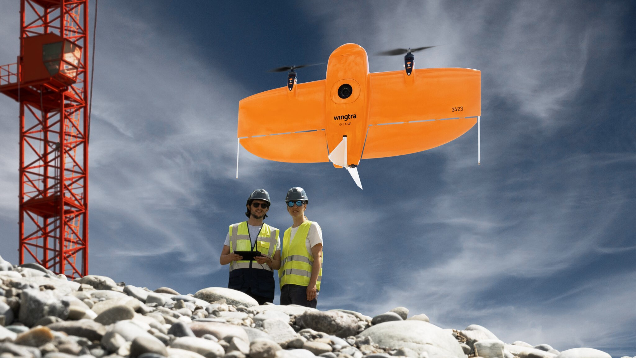
UAV and Drone Survey Solutions
Our team stays on top of the latest drone innovations so you don’t have to. We constantly evaluate new technology, products, and partners to bring you the best solutions in the industry.
We offer products from leading drone manufacturers in the industry, such as Wingtra, DJI, Microdrone, and more. Our team will help you sift through the wide range of options, including units with heavy payload capacity, highly customizable cameras, or the unique ability to take off and land in tight spaces, to find the right UAV for your mine site.
Available Payloads
Additional sensors, devices, and integrations are available for many models. We offer flexibility and multiple options, including LiDAR, photogrammetry, and multispectral.
Emesent technology is an excellent option for the mining industry; attached to UAVs, it captures fast, accurate, and high-detail mobile data. Emesent Hovermap ST uses the latest LiDAR technology to build high-density point clouds with unparalleled coverage.
LEARN MORE
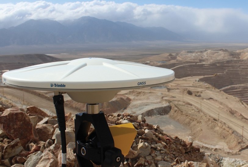
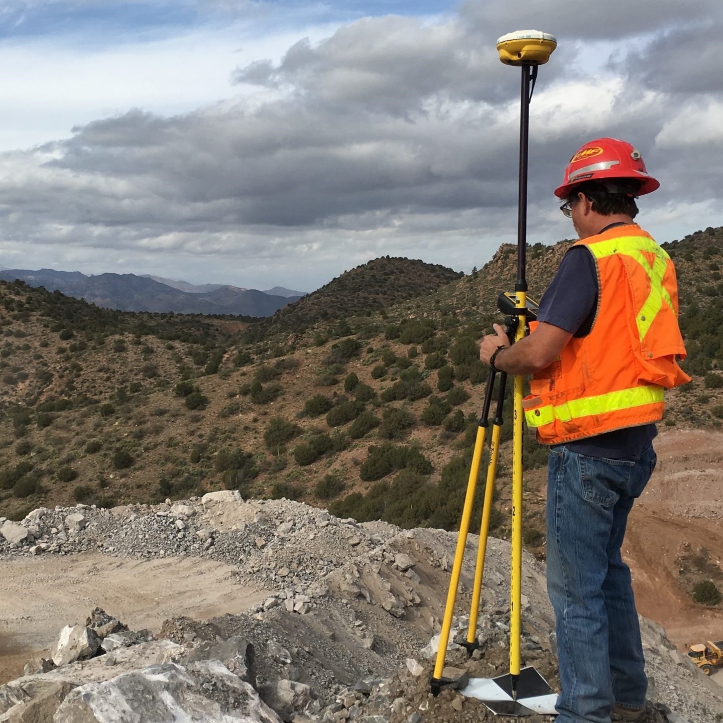
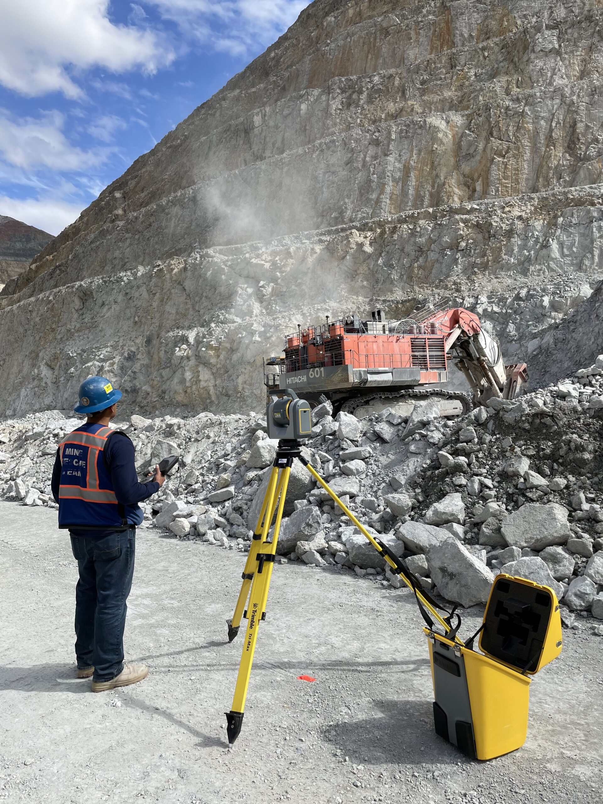
Survey and Positioning Solutions
Better management of the whole mining project starts with accurate positioning. Even if you're new to GPS technology, you can easily use the hardware and software offered by Trimble that makes it easier to locate, measure and track digital information. You can depend on our team of experts to help get you started.
Trimble Siteworks Software, offered by SITECH, is a powerful tool designed to help mining surveyors work more efficiently and effectively. With this software, you can work with complex 3D models, quickly collect large data sets, and visualize complex 3D models more easily.
Site Positioning Systems provide the accuracy and reliability required from mining operations to increase safety and improve critical processes. With advanced technology capabilities, the way mines work can be transformed through a connected source of information that spans from the offices to the field and back in real-time.
CONTACT US
Site Data Management Solutions
A common challenge in the mining industry are continual upgrades that survey and positioning systems require. We are working with in territory mines to introduce Trimble Products as a Service (TPASS). It’s a subscription model allowing jobsites to consistently upgrade to new hardware and software with smaller monthly payments and forgoing a large capital expense.
SITECH can help you stay connected and up to date with automatic data transferring between devices anywhere with Trimble WorksManager. We also offer Trimble Works OS - created for site supervisors and project managers to maximize jobsite efficiency, work tracking, and jobsite data from the field.
Wireless Networks
Continuous communication between all equipment and personnel is essential at mines, as it improves mobility and efficiency to benefit your projects and workflow. Mesh networks can meet this need and are becoming a standard for many mining projects. Bring wireless to your mine with Rajant Kinetic Mesh, a leading industrial wireless mesh network that supports M2M communications. It's fully mobile and can intelligently adapt to change, ensuring mission-critical operations remain uninterrupted.
SITECH Southwest's partnership with Rajant brings their wireless mesh network products for mining to our customers. Rajant products, backed by the support of our mining technology experts, allow our customers to communicate efficiently and reliably.
Slope and Highwall Monitoring
We can help you eliminate manual field measurements, simplify sensor configuration, and add flexibility to your reporting. Additionally, you can reduce costs and access real-time sensor data, analytics, and state of-the-art visualization tools to substantially reduce risk.
We can design and implement a data capture solution using connectivity devices or pair with existing hardware and Wi-Fi infrastructure. Our platforms easily connect and integrate sensors for:
- Tailings Dam Management
- Slope Stability Monitoring
- Environmental Monitoring and Compliance Reporting
- Groundwater Management
In working closely with Alterra, our T4D geospatial partner, our team can help deliver fully operational mining slope systems using T4D Control, an automated movement detection system that enables surveying and mining professionals to make informed decisions with confidence. With T4D Control, you can configure optical, GNSS, and geotech sensors, manage monitoring data, apply geodetic corrections, report, visualize, and share analysis with other project stakeholders. Trimble has invested significant resources into T4D, ensuring frequent upgrades with new features, to keep this product at the top of its game.
REACH OUT TO THE SITECH TEAM
We offer exceptional mining services to Arizona, Nevada, and Southeast California!
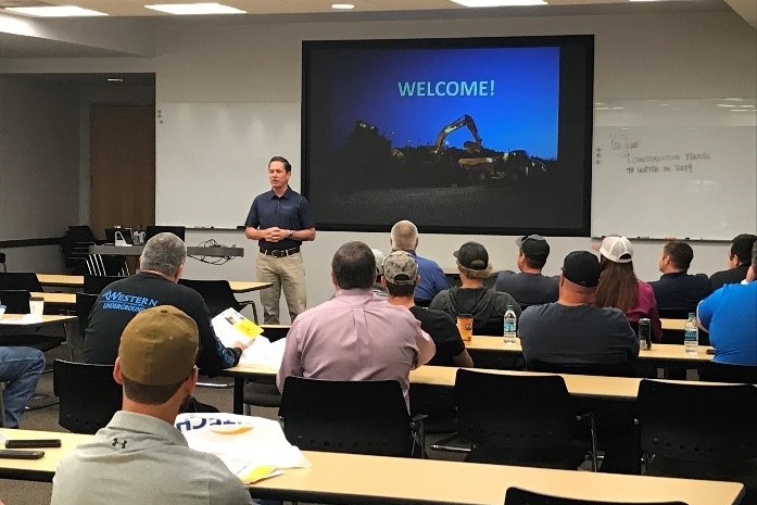
Engineering Consulting & Training
Whether you are a beginner looking to get up to speed quickly or a seasoned professional wanting to streamline productivity, our Trimble-Certified instructors are ready to fit your needs. Explore the types of trainings we offer from hardware, software, and events, or contact us at 602-600-0214 to customize a class just for you.
We offer courses in UAVs, site positioning, mining applications, and more!
REGISTER TODAY